Tulare Lake, drained decades ago, may return after California’s record-breaking storms
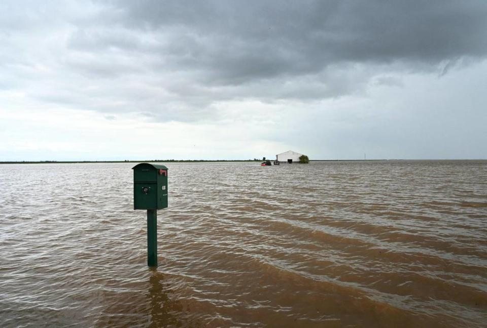
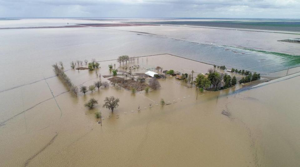
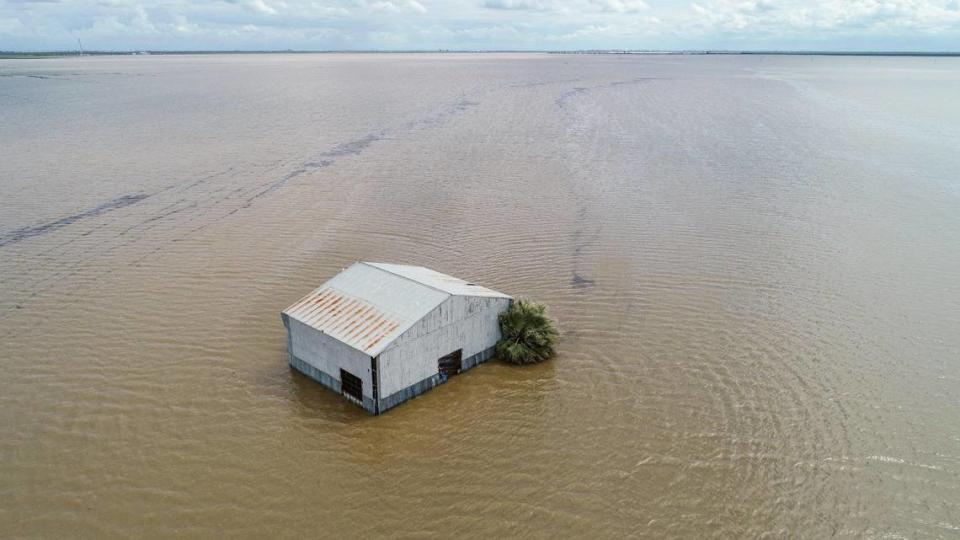
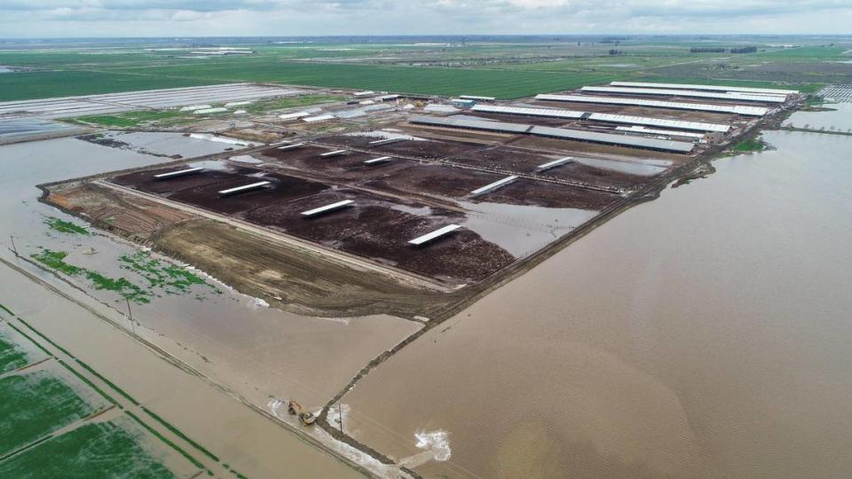
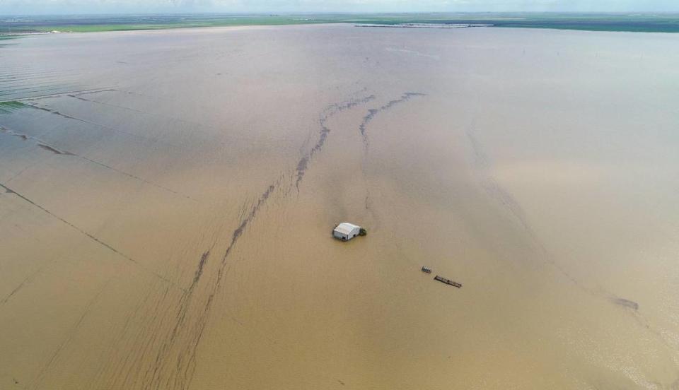
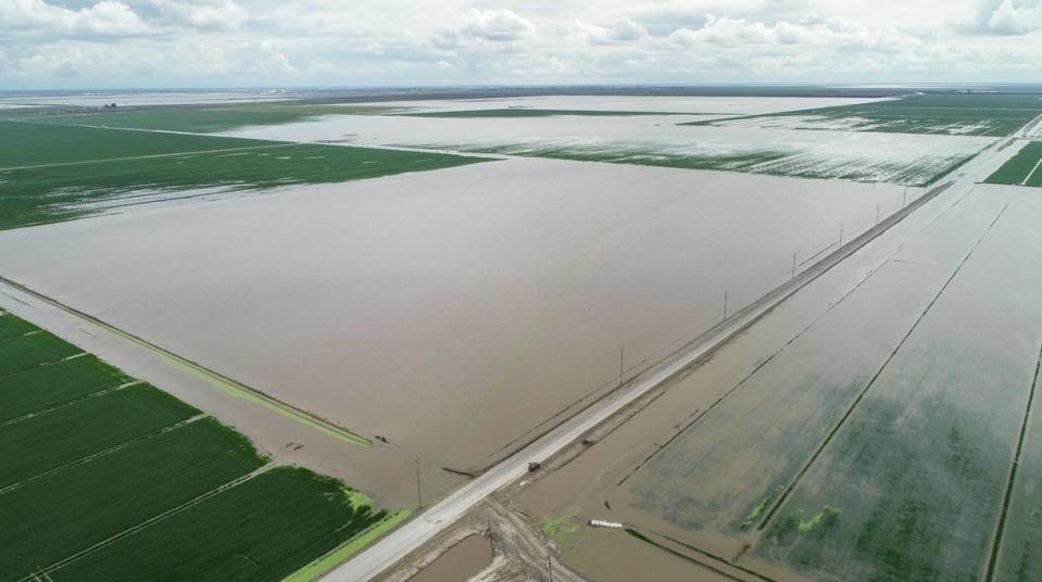
The historic and long-gone Tulare Lake is on the verge of dramatically reappearing because atmospheric rivers pounding California are leaving water managers with no other place to divert flood releases.
All that incoming water is giving farmers on the lake bottom a headache, but environmentalists see it as an opportunity to restore the lake – perhaps permanently – which last emerged in 1983 in another big wet year.
Meanwhile, officials in Corcoran – situated in the old lakebed south of Fresno and the site of two state prisons – said recently reinforced levees will protect the city when the record southern Sierra snowpack melts.
But at the moment, some communities aren’t so lucky.
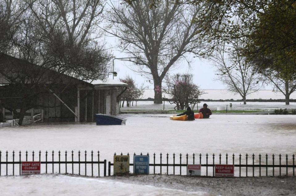
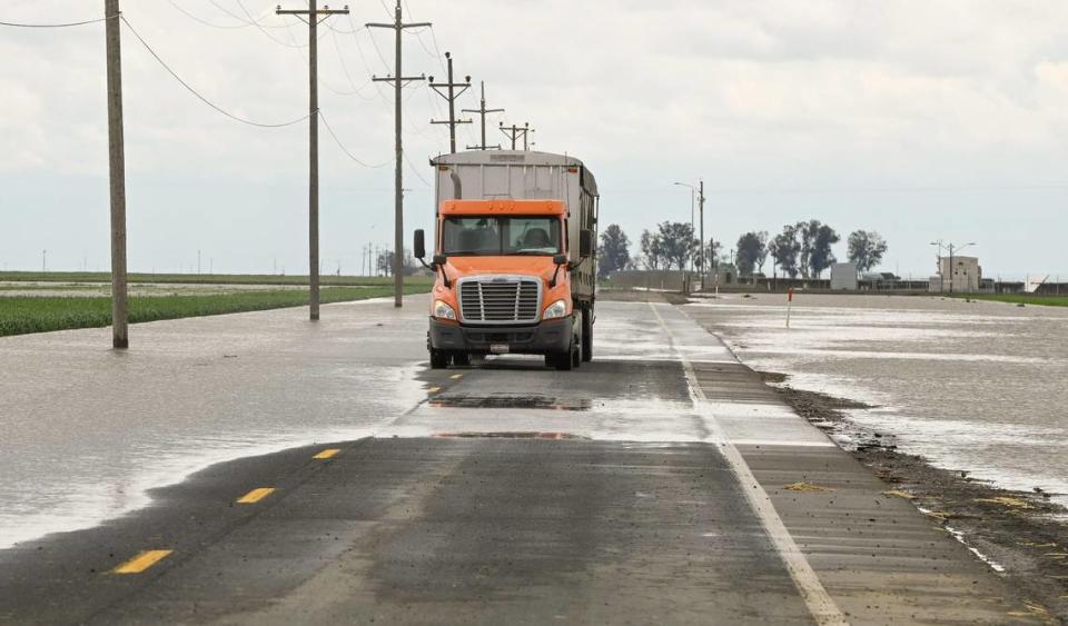
Nearby Allensworth and Alpaugh in Tulare County are both under evacuation warnings as water from overflowing rivers surround the small towns, and more water from spring snowmelt that water managers upstream can’t handle could add to their woes.
HISTORY OF TULARE LAKE
The history of the old Tulare Lake has long fascinated author Mark Arax of Fresno, whose book “The King of California,” co-authored with Rick Wartzman, tells how the Boswell farming company and others converted Tulare Lake to farmland.
Speculation that the lake might come back this year has released a torrent of interest nationally, Arax said.
“I’m getting calls from around the country from people who are following the drama of the lake coming back,” he said. “Some of them are even rooting for nature to outflank man and see the old Tulare Lake alive again.”
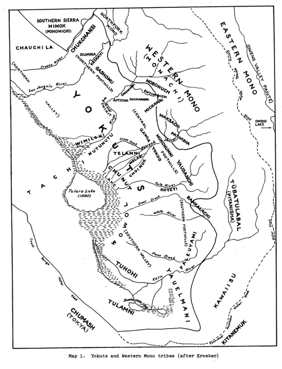
Before the Gold Rush, Tulare Lake covered about 800 square miles, Arax said.
“The lake was the most dominant feature on the California map,” he said.
The size ebbed and flowed with rainfall and snowmelt coming in from the Kings, Kern, Kaweah and Tule rivers and other smaller streams. There’s no outlet to the Pacific Ocean, but in very wet years as the lake level rose, water could spill north into the San Joaquin River drainage. (The last time the lake overflowed was 1878, according to water historian John Austin, author of “Floods and Droughts of the Tulare Lake Basin.”)
Yet in some years the ground was so dry and rough the horses of explorers would get their hoofs caught in animal holes, he said.
The lake was wide and relatively shallow and teemed with fish and shellfish, sustaining four distinct Yokuts tribes who lived around the lakeshore.
“The women would fish the bottom with their toes, bringing up mussels and other mollusks,” Austin said.
After the Gold Rush, settlers moved in and diverted the rivers for irrigation, causing the lake to shrink but not entirely disappear.
Then in the 1920s, cotton farmers from the Southern states – among them J.G. Boswell – came west and began to farm cotton on the lake bottom and did everything they could to keep water from pooling there.
It took more than 30 years, but they succeeded, Arax said.
The landowners petitioned for the construction of dams on the major rivers feeding the lake that to this day are keeping water out of the lake bottom, he said.
“This is arguably the most re-engineered landscape in the West, if not the country,” Arax said. “No land has been more reshaped than the Tulare Lake basin by dint of canal, ditch, dam and pumps that made the rivers run backward. It’s an immense act of hubris.”
But wet years like this one can overwhelm the system. The lake re-emerged in 1969 and 1983, and 1997 was also a wet year.
And now it’s happening in 2023.
HOW LONG WILL WATER FLOW TO TULARE LAKE?
The Army Corps of Engineers said this week it would start releasing more water from Pine Flat dam, but instead of moving the water through the north channel toward Firebaugh and the San Joaquin River, it will be sent south to Tulare Lake because the north channel is full.
Those flood releases will last “indefinitely” until summer, the Corps said.
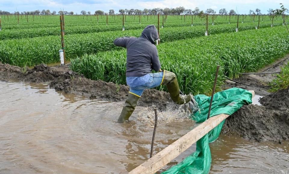
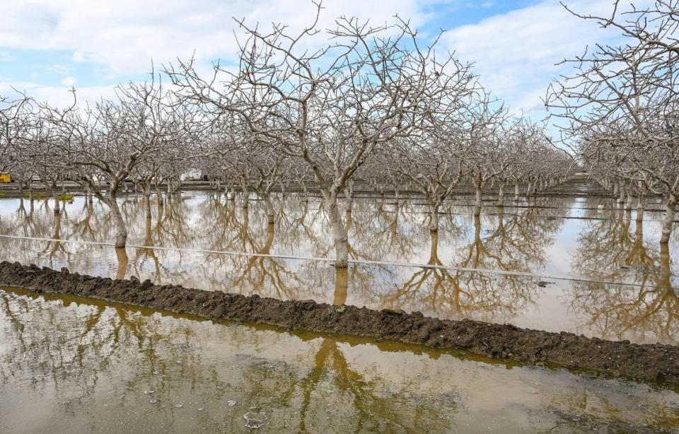
For lake bottom farming interests, a re-emerged lake means they can’t farm. Arax called it a self-inflicted wound.
“They have planted thousands of acres of pistachios down there,” he said. “It’s crazy to think you could do that at the bottom of a lake.”
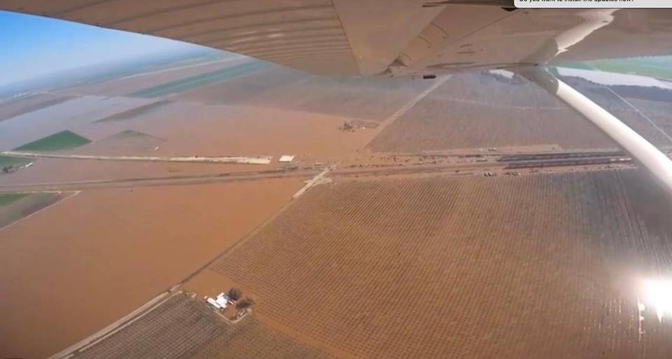
The big farming companies are ignoring their own history, Arax said.
“The old calculus was we are farming a lake bottom, and we must respect the land, so we plant row crops,” he said.
“The new calculus is we can plant permanent crops in the lake.” Arax said. “In the last 20 years, they attempted to do something that old man Boswell and old man Salyer (Clarence Salyer, another of the region’s farming titans) would not have done. It’s an act of greed, and some would say stupidity.”
A call to the J.G. Boswell Co. for comment was not returned, although an employee politely took a note and said it would be passed on.
ENVIRONMENTALISTS SEE HOPE FOR CHANGE
The idea that the lake might come back is thrilling to environmental law attorney Richard Harriman.
“I view this as a blessing from the gods,” he said. “It’s an opportunity to revisit the short-sighted decisions to drain the lake.”
He said he’d like to see the establishment of a Tulare Lake Conservancy that would acquire a portion of the lake.
“I would call it a reservoir without a dam,” he said.
Such a group should include environmentalists, public officials, farmers and Native Americans, he said.
Farmers could continue to farm elsewhere on the lake bottom, he said.
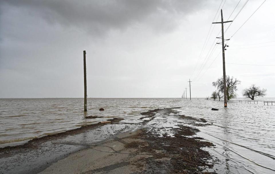
“We need to work together,” he said “This is an opportunity disguised as a problem.”
The timing is right because the Sustainable Groundwater Management Act of 2014 will be limiting groundwater pumping, he said, so it’s inevitable that a lot of farmland around the lake bed will eventually be taken out of production. The law pairs nicely with lake restoration efforts, he said.
ALLENSWORTH UNDER SIEGE
But some advocates say it is premature to push the “Restore Tulare Lake” mantra because so many underserved San Joaquin Valley towns are enduring flood problems, or are at risk of flooding as the big snowpack melts.
Dezaraye Bagalayos, director of program coordination for the Allensworth Progressive Association – a partner in a habitat restoration effort – issued a plea on Twitter for advocates to focus on the present.
“I’m going to try to say this as gently as I can. For those expressing excitement & glee over the ‘Tulare Lake coming back’ you need to realize how truly heartless this is right now.”
Homes in Allensworth, which has a population of under 600, are threatened by rising water from a river that should be flowing into Tulare Lake, she said. But to keep it away from farmland, some farming interests are allowing it to back up toward Allensworth, she said.
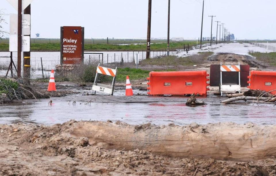
“So where does it go? It slowly creeps into underserved, marginalized, disenfranchised, communities of color,” she tweeted.
Allensworth, on the edge of the old Tulare Lake, was founded more than 100 years ago as a self-sufficient Black community. Col. Allensworth State Historic Park is nearby.
CORCORAN IS ON HIGH ALERT
Corcoran, a city of about 22,000, is located in Kings County in the footprint of the old Tulare Lake.
The city this week declared a local state of emergency to get ready for a rising lake that could threaten the city.
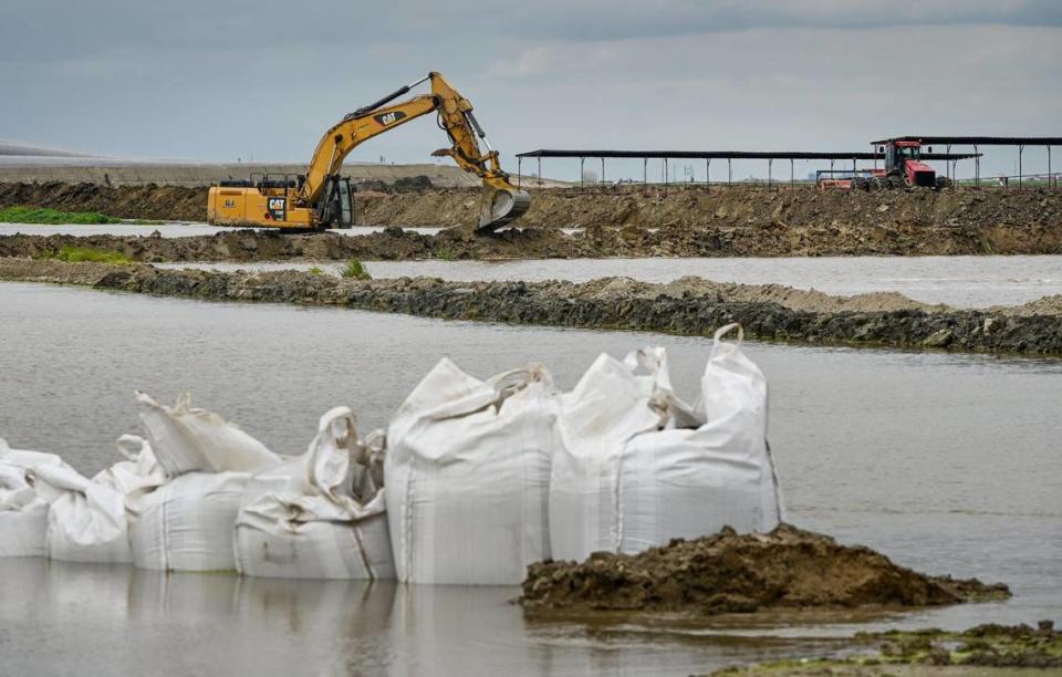
But If the lake returns this summer as expected, a levee to the west will protect the city, the city manager said. Five years ago, more dirt was brought in to raise it several feet, a project of the Cross Creek Flood Control District.
City manager Greg Gatka said the top of the levee, which would hem in a rising lake, is about 188 feet above sea level, while the lowest point in the lake bed is about 166 feet, he said.
“There’s a lot of space still out on the lake bed,” Gatzka said.
Concerns that levees won’t protect the city due to land subsidence ignores the fact that the lake bed is also sinking and is still more than 20 feet lower than the levee, Kings County Supervisor Doug Verboon said: “We feel the levees will work. Our No. 1 goal is to protect the lives of residents of Kings County, and the No. 1 priority is Corcoran.”
The old Tulare Lake covered 120,000 acres, he said, and at present no one knows how much water will come to the lake bottom when the snow melts.
Recently and unexpectedly, water from the Tule River overflowed and came up to streets near the two state prisons on the far south of Corcoran.
That really shook up Corcoran residents.
“There is concern and panic,” Gatzka said, “There’s a lot of misinformation. People think they need to evacuate.”
But that’s not the case, he said.
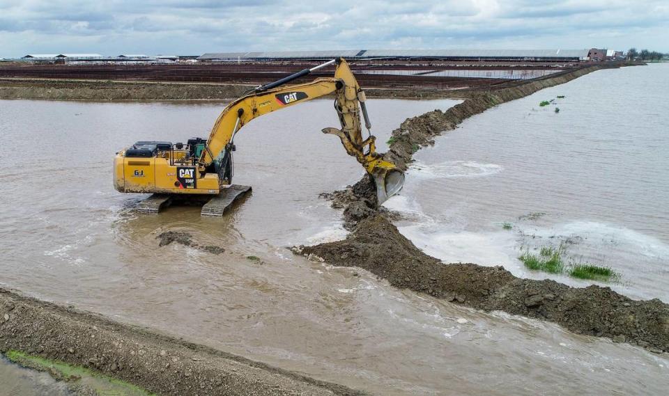
To alleviate the problem, a levee south and west of town in Reclamation District 749 was cut by the J.G. Boswell Co. so the backed-up Tule River water can start going toward the lake bed to be managed by Boswell in large cells, Gatzka said.
The Kings County Board of Supervisors required Boswell to make the cut, Supervisor Verboon said.
“They weren’t happy at first, but they are working with us,” he said.
Meanwhile, the California Department of Corrections and Rehabilitation, which operates both Corcoran State Prison, which currently has 3,384 inmates, and the Substance Abuse Treatment Facility, which has 4,658, said it’s watching the situation.
“The health and safety of all those who work and live within our institutions is our primary concern,” a statement said. “Institution leadership at both SATF and Corcoran prisons, as well as CDCR headquarters, are closely monitoring the situation and coordinating with state and local emergency response agencies. At this time, there is not an imminent threat and there is no order to evacuate either institution.”
WATER MANAGERS GET READY
Water managers say the danger to the public from flooding will continue when the first hot spell begins melting the Sierra snowpack.
“This is just the beginning,” said Randall McFarland, a spokesman for the Kings River Water Association. “The problem starts when the snow melts in April.”
There’s an estimated 2.5 million to 3 million acre-feet of water in the King River watershed; Pine Flat Lake, The primary flood control on the Kings, holds 1 million acre feet, The math is simple, McFarland said; the runoff is going to go somewhere, and for the foreseeable future that’s into Tulare Lake.
In Tulare County, Lake Success reached the “fill and spill” stage for several days during the atmospheric river rainstorms, causing flooding along the lower Tule River and water to go toward Tulare Lake. More flood releases are certain as the snowpack melts.
In normal years, most of the water is diverted for irrigation and recharge, and very little goes to the Tulare Lake bed.
This year will be different, said Eric Limas, general manager of Lower Tule River Irrigation District.
The district will use as much water as possible for irrigation and groundwater recharge, but lots of water will still be heading west toward Tulare Lake.
“We’ll do our best to keep as much water out of the lake as possible,” he said.




 money
money 