Proposed Indianapolis city-county council map earns Republican support
A new Indianapolis City-County council map could give Republicans more seats in Democrat-heavy Marion County after passing through committee with little public comment Tuesday. The new map could make its way to the full council for a vote as soon as next month.
The 8-2 vote garnered support from most council Republicans, whose party had cried foul over the redistricting process at the local level.
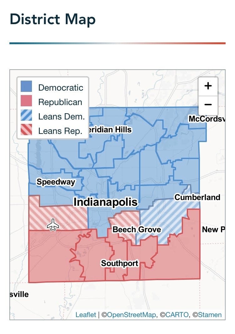
The new council seats, redrawn every 10 years to reflect the latest population changes recorded in the U.S. Census, adds another seat in the most southern border of Marion County. The new map appears to have five solidly Republican districts to the area as opposed to the current four.
The new southside: This area has grown the most in people of color in the past decade
The new map appears to be fairly balanced, according to statistical analyses from the PlanScore mapping tool uploaded by Common Cause Indiana. In one statistical measure of partisan fairness, the map skews slightly Republican. In another, the map skews Democratic.
City councilors will now represent roughly 977,000 residents, up from the 2010 count of roughly 903,000. That amounts to roughly 39,000 constituents in each of the 25 districts.

The new map also creates competition among Democrats, drawing councilors Monroe Gray and Keith Potts into one district on the north side and councilors Jason Larrison and David Ray into another on the east side.
It's unclear which of those four Democrats may choose to seek reelection in 2023.
Democrats currently hold a supermajority on the council with 20 seats compared to Republicans' five.
Gray joined Republican Michael-Paul Hart in voting against the map on Tuesday.
He told the IndyStar before the meeting that he thought that map drawing was targeted — that Gray's actions may have upset members of his party over the years, most recently when he spoke out against the power wielded by the local Democratic Party chair.
"When you don’t agree with the powers that be all the time then that’s the one chance they have to get you," Gray said.

Hart voiced a need to allow residents to see and comment on the proposed map, a concern also pushed by Common Cause Indiana. The other three Republicans on the committee voted in support.
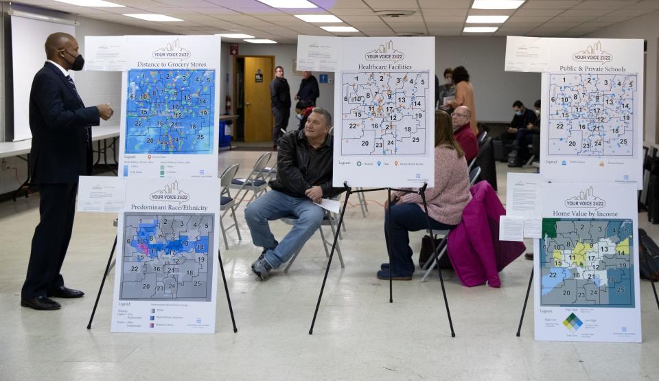
The map was publicly revealed after sparsely attended public forums in each of Marion County's nine townships.
Council President Vop Osili countered the redistricting process has occurred for several months with invitations for public engagement.
"We could go through this process for the next three years ... and never get it right," he said. "Never get to the satisfaction of 977,000 individuals."
Other districts to watch
Another three districts could also swing Republican. District 17, encompassing the southern part of Wayne township, leans Republican, according to an analysis from the PlanScore mapping tool completed by Common Cause Indiana. District 19, encompassing the west part of Beech Grove, leans Republican as well.
The adjacent District 2 encompassing the east part of Beech Grove may also be a toss up in future elections, but leans Democratic.
The new District 4 encompassing the Geist area also looks like it may be a toss up.
Changing Indianapolis: These areas, once predominantly Black, are becoming more white
The PlanScore analysis, however, only measures ballots as they were cast in the last 2020 election between Donald Trump and Joe Biden. Political leanings could vary from that divisive national election.
Councilor Ali Brown, who won her current council seat against a Republican in 2019, told the IndyStar the new District 10 she will compete in is good for the people of Lawrence.
"I'll be able to represent them strongly after my reelection," Brown said. "They'll have one councilor to look to instead of having to try to figure out who they need to talk to about what road."
Councilor Jared Evans, who has kept his seat as a Democrat in an area with a formidable Republican challenge, told the IndyStar he plans on running for reelection to his new Republican-leaning District 17.
That area is always going to be a political challenge, he said.
"But that's not something that's hindered my thought on running for reelection," Evans said. "I think that's one of the beauties of it, in the sense that you've got to work on issues that mean something to the people."
Neighborhoods united and divided
Drawing the new map requires a delicate balance of maintaining equal population and ensuring that people of color are not disproportionality packed in one district or skewed throughout multiple areas.
The new map combined a number of neighborhoods whose residents asked to be united, or areas that combined into one clear community of interest, Brandon Herget, policy director for the council, told the committee Tuesday.
That includes Irvington, which is primarily located within the new District 14 instead of being split among multiple districts.
The Fountain Square, Fletcher Place and Bates-Hendricks neighborhoods — previously divided into three council districts — are also now in one district.
Decatur Township, too, is included within one new District 21 instead of split in two.
The new map also contains a majority of Lawrence primarily within the new District 10.
But councilors heard from residents of at least one neighborhood, North Kessler Manor, who expressed opposition to being split into two council districts.
The map now awaits full council approval. Indianapolis must approve a new map by the end of 2022.
Call IndyStar reporter Amelia Pak-Harvey at 317-444-6175 or email her at apakharvey@indystar.com. Follow her on Twitter @AmeliaPakHarvey.
This article originally appeared on Indianapolis Star: Proposed Indianapolis council map earns Republican support

 money
money 