
 money
money Millions of U.S. homes at risk of climate-related disasters, but few Americans know it
Already weary from this summer’s record-high temperatures, flash floods and wildfires, Americans will face even more extreme weather in the coming decades as the Earth hurtles toward irreversible climate change.
This week’s report by the U.N. United Nations' Intergovernmental Panel on Climate Change highlights a cascade of calamities in store as the world’s inability to curb greenhouse gas emissions reaches a critical point.
That means more flooding, more fires and more wild weather swings threatening U.S. homeowners from coast to coast.
But few Americans even know they’re at risk.
The federal government has underestimated the threat of some of the biggest climate-related disasters by relying on outdated numbers and failing to take into account the effects of a warming planet, several experts told USA TODAY.
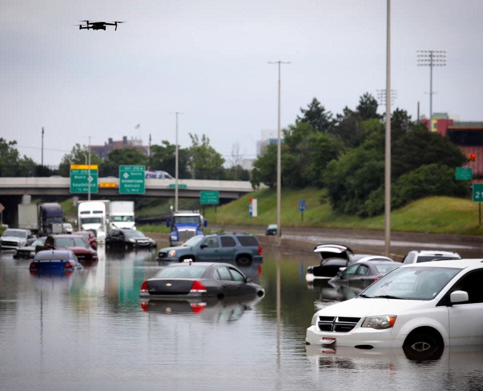
On flooding alone, nearly 6 million more homes and commercial properties are at risk than identified on the Federal Emergency Management Agency’s floodplain maps, according to a recent analysis by the nonprofit First Street Foundation.
Similarly, more homes face extreme risk of wildfires than current projections by the USDA Forest Service, the First Street Foundation said.
“There is no one from the government trying to tell you what your risk is,” said Matthew Eby, First Street Foundation’s founder and executive director. “FEMA is set up to run the national flood insurance program, which is completely different from how you communicate risk to someone. It’s the same thing with fire – the Forest Service is trying to figure out how to manage forests, not to tell you the risk to your home of wildfires.”
First Street Foundation is one of a handful of private organizations that now offer free risk assessment tools to homeowners so they can understand the likelihood of facing a flood, fire or other climate-related threat. Its Flood Factor tool, which launched last year, estimates current and future flood risks on a scale of 1 through 10.
The group also plans to offer a wildfire risk assessment tool in 2021.
Another startup, called ClimateCheck, provides a similar feature that shows a property’s current and future risk of facing any number of climate threats like flooding, fire, heat, drought and storms. Its rating ranges from 1 to 100. Both ClimateCheck and the First Street Foundation have partnered with real estate websites to embed their scores into home listings.
The tools, while helpful to homeowners and homebuyers, reveal a nation at risk. And they expose a decades-long bungling of climate planning and policy at multiple levels of government across the country, experts said. They also present difficult new questions about who will pay billions of dollars to save communities.
“Who is going to pay and how we are going to pay is the ultimate question,” said A.R. Siders, a professor at the University of Delaware’s Disaster Research Center.
Millions face flooding
FEMA has struggled to maintain accurate flood maps since the inception of the National Flood Insurance Program 50 years ago.
Its maps designate properties as either inside or outside the flood risk zone. Those inside are required to purchase flood insurance if they have a federally backed mortgage. For those outside, coverage is optional.
But the maps maps can be outdated, miss lower-priority areas and at times become subject to political influence through a revision process, said Eric Tate, a professor at the University of Iowa who early in his career built flood modeling tools as a FEMA contractor.
“As a result of all of these, there’s a lack of uniformity nationwide,” Tate said. “You have a map here that’s based on this set of data, and this way of analysis. And then you have another map somewhere else, and it’s different.”
A July report by the U.S. Government Accountability Office also chastised FEMA for outdated flood maps that fail to take into account how climate change might affect the risk.
First Street’s model found that about 14.6 million homes and other structures across the country face a 1% annual risk of flooding, representing about one out of every 10 such real estate parcels nationwide. But current FEMA maps list just 8.7 million properties in the floodplain, a 40% undercount compared with what First Street found.
And the situation is getting worse. In addition to a present-day analysis, First Street’s modeling incorporated 2050 projections from the International Panel on Climate Change, the United Nations’ primary scientific body on the issue. The conclusion: Another 1.6 million properties will be at 1% annual risk of flooding by 2050.
The 1% threshold is the gold standard used by the federal government to assess which homeowners are required to purchase flood insurance. But experts say it’s also misleading because it actually equates a 1-in-4 chance of flooding over the course of a 30-year mortgage. Local and county planners also use the threshold to determine which areas are safe to develop.
FEMA is set to roll out a new pricing model called Risk Rating 2.0 that could boost insurance premiums for thousands of flood insurance policy holders when it takes effect this fall. But the flood maps will not change, meaning households outside the risk zones are still not required to purchase flood insurance.
“Risk rating 2.0 will correct the pricing for those homes, but how will those homes ever know about their actual risk if they’re not changing the flood hazard area?” Eby said. “If I don’t know I need insurance, how will I know that the price point is changing?”
First Street’s analysis, which used a uniform modeling system across the lower 48 states, helps expose the potential scale of missed risk. Many of the largest discrepancies are driven by states and cities not typically considered at high risk for flooding. In California, nearly 600,000 properties are at 1% annual risk for flooding under First Street’s model, but not under FEMA’s. That’s the largest gap of any state, driven by big jumps in cities like Los Angeles and Fresno.
Similar gaps exist in New York, Pennsylvania, Texas and Tennessee, driven by underappreciated risks in cities such as Philadelphia and Chattanooga.
Chicago leads among all cities: First Street calculates that nearly 76,000 additional properties there should be in the floodplain.
FEMA’s maps and First Street’s model depict different kinds of risk and serve different purposes, said FEMA press secretary Lizzie Litzow.
The federal agency is charged by Congress with mapping current flood risk, and its flood data is used for floodplain management and for life and safety during a flood. It works with local and state government officials to gather information to prepare and update maps and allows local officials to submit additional data to ask for map revisions.
The agency sees First Street’s Flood Factor as a tool to inform a property owner’s decision to buy flood insurance or take steps to reduce individual flood risk, Litzow said.
FEMA’s maps remain the backbone of effective floodplain management, said David Maurstad, the agency’s deputy associate administrator for Insurance and mitigation. Local adoption of minimum standards based on the maps helped avoid $100 billion in losses over the past 40 years, he said.
FEMA’s regulatory maps depict the 1% chance annual event, but flood risks exist outside that flood plain, Litzow said. By the agency’s own accounting, 20% of flood claims come from properties outside high-risk flood zones.
Although people try to compare flood maps to actual events, Litzow said, it’s “not an apples-to-apples comparison.”
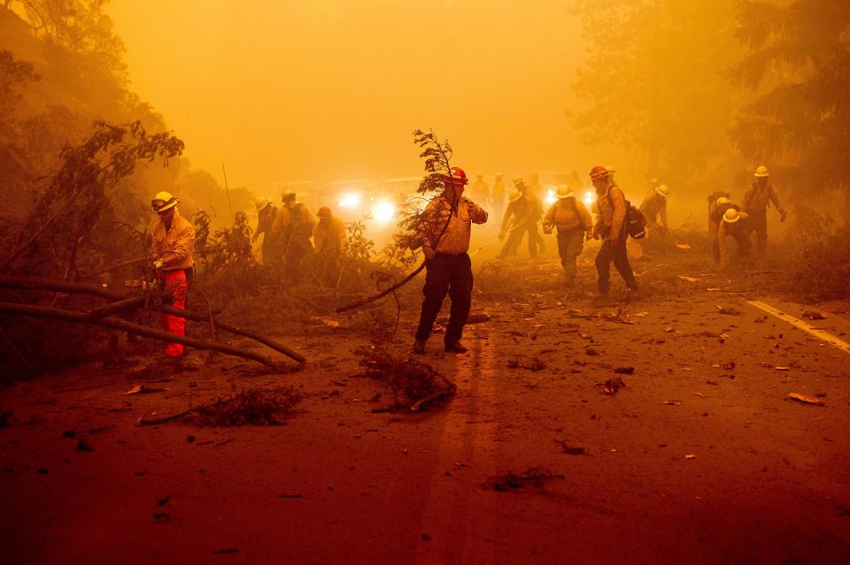
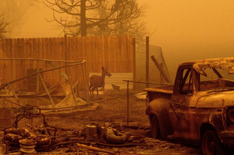
More Americans at risk of wildfire
The government also provides the public information about the threat of wildfires through its Wildfire Risk to Communities website.
Created by the USDA Forest Service under the direction of Congress in 2018, the site “uses the best available science to not only identify risk, but also provide resources for communities to manage and mitigate risk.”
But the website isn’t meant as a tool for people to identify their individual property risk – it’s designed for elected officials, land use planners and fire managers. And rather than provide insight about the direct risk of wildfire to a parcel, a neighborhood or even a community, the website shows each area’s risk only relative to another area.
Further limiting its usefulness, the data upon which the risk assessments are based is old, dating from before 2014 even though wildfire risks have grown exponentially in the seven years since that time.
Nearly half of all wildfire damage since 1980 has happened in the past three years alone, Eby said.
“In 2020, there was $16 billion in damage in a single year, and now we have the second-biggest wildfire in California history going on right now,” he said. “If you use the current climate to calculate the risk, you’ll see a dramatic increase” from what the federal government’s website reflects.
The future risk will increase even more when factoring in climate change, he said.
Cal Inman, CEO of ClimateCheck, says people deserve to be informed about the current and future risk of wildfire. The six counties most at risk for wildfires are among the fastest-growing counties in the country, according to an analysis by ClimateCheck. Those fire-prone areas are in California, Idaho, Utah and Washington.
The population of Placer County, California, which has the highest wildfire risk – 98 out of 100 – in the country, grew by 7% in recent years, making it one of the fastest-growing counties in the country. Similarly, Morgan County in Utah grew by 17.5% and has a wildfire risk of 95 out of 100.
The other four counties that saw population growth and faced a severe risk of wildfire are Chelan County in Washington, Franklin County in Idaho, Weber County in Utah and Ventura County in California.
While insurance and investment companies, such as Blackrock, have long used their own private models to make decisions, the risk assessment tools developed by First Street Foundation and ClimateCheck democratize the data and put it in the hands of average citizens.
“I don't think people are factoring climate risk into the decision-making the way they do price point, proximity to work, proximity to school,” Inman said. “We’re just trying to arm the consumer with one more data point to make a decision about where to live.”
Those decisions will become increasingly important amid this week’s climate change report from the U.N. that predicts a more hostile environment because of global warming.
The report projects that in the coming decades climate changes will increase in all regions. For 1.5 degrees Celsius of global warming, there will be increasing heat waves, longer warm seasons and shorter cold seasons. At 2 degrees Celsius of global warming, heat extremes would more often reach critical tolerance thresholds for agriculture and health, the report shows.
Wild weather events – from storms to heat waves – are expected to worsen and become more frequent.
“Climate change is already affecting every region on Earth, in multiple ways," said Panmao Zhai of the IPCC. "The changes we experience will increase with additional warming.”
This article originally appeared on USA TODAY: Climate change threatens millions of American homes with flood, fires
